
Norway
Alva's Kjeragbolten story
Alva’s Kjeragbolten hike above Lysefjord — a 10 km, 6–8 hour trail story with honest notes on chains, weather, rock slabs, pacing and when to wait.
Trail story
Route basics
At a glance
- Distance
- 10 km round trip
- Duration
- 6–8 hours
- Difficulty
- Moderate to demanding
- Best months
- May–September, depending on snow
- Start
- Kjerag Parkering
- Trail
- Out and back
- Parking
- Paid parking
- Elevation
- About 1000 m
NoteWeather, daylight and trail conditions can change quickly. Check local conditions before hiking.
On this page
I am Alva, and I reached Kjerag parking while the morning was still quiet. The road had already done part of the work, lifting me high above Lysefjord, but the trail did not offer a gentle introduction. From the first minutes, it asked for legs, grip and attention.
I had not come only to collect a photograph. Kjeragbolten was the landmark, yes, but the day around it mattered more: the paid parking at Øygardstøl, the first steep pull from the car, the smooth slabs where chains help with balance, the open plateau where weather feels closer, and the same route back when tired legs can make simple steps less simple.
Route rhythm
My route rhythm
- 01Kjerag parking
I leave the car and the climb begins almost immediately.
- 02First steep climb
An early test of legs, grip and the mood of the weather.
- 03Chain-assisted slabs
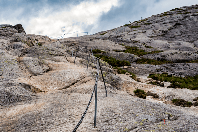
The chains help me stay steady on smooth rock.
- 04Open plateau
The terrain widens, but wind and fog matter more here.
- 05Kjeragbolten
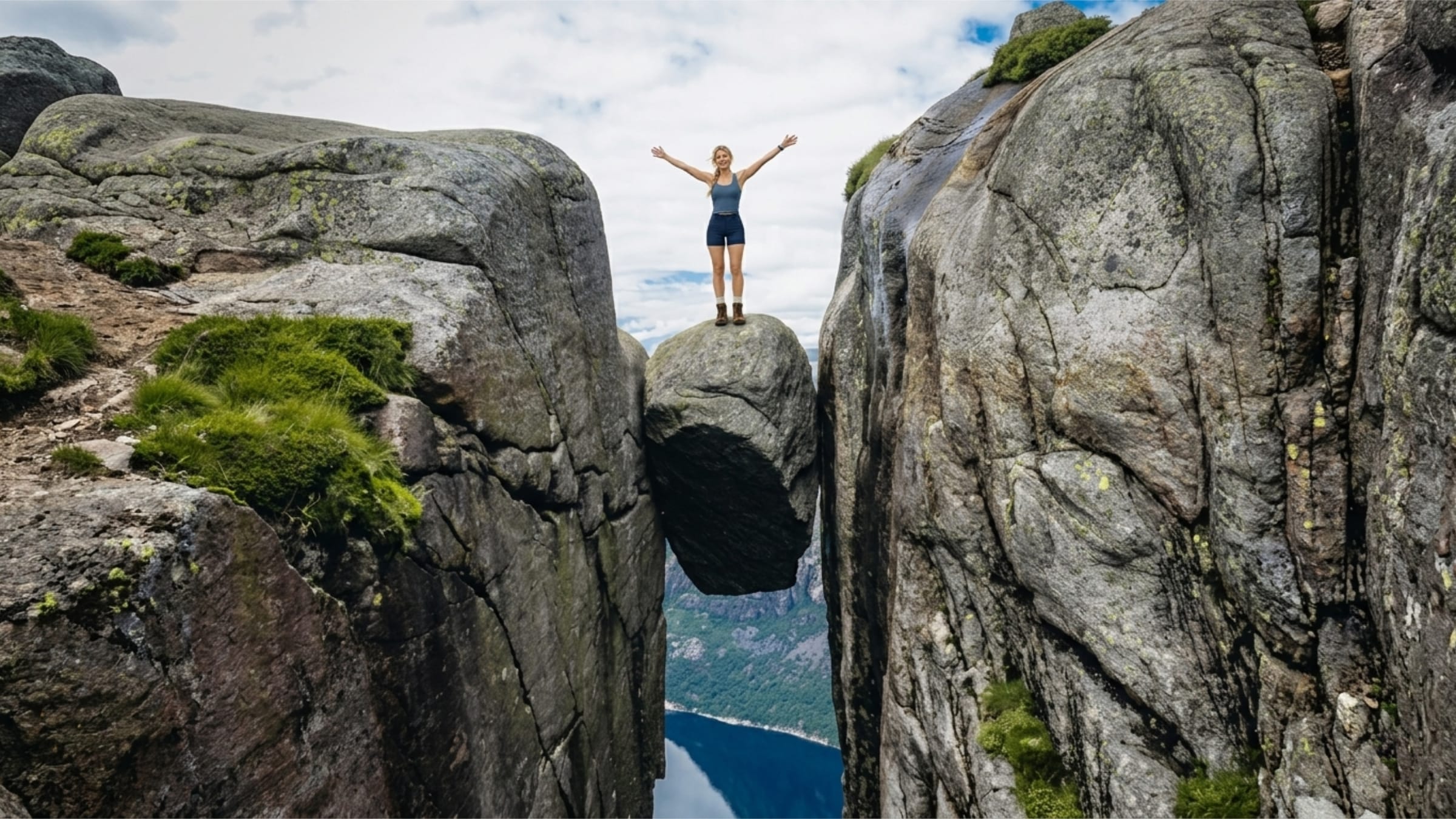
The boulder is the famous point; stepping onto it stays optional.
- 06Return the same way
I save focus for the descent and the chain sections.
Why I chose Kjerag
I chose Kjerag because it was not only a viewpoint. The hike had a clear shape: about 10 kilometers out and back, usually 6-8 hours, with enough ascent and rock to make the day feel earned. It would not be a casual stop between other plans. It needed its own space.
The boulder was part of the pull, but I liked the honesty of the route more. Kjerag does not hide the work. The trail rises quickly, crosses bare stone, opens into higher ground and only then lets the fjord feel close. On a dry, settled day, the difficulty sits somewhere between moderate and demanding. In wet rock, fog or wind, that balance changes.
I also knew the season mattered. May to September can work, depending on snow, but early or late in the season asks for more caution. A calendar date is never as useful as the actual condition of the trail underfoot.
Before my Kjerag hike: parking and preparation
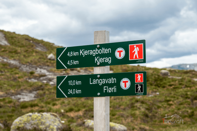
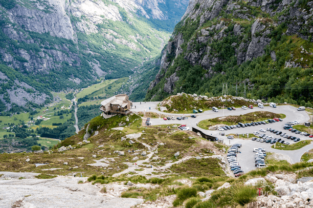
At Kjerag Parkering, I did the small things that make the rest of the day calmer. I tightened my laces, checked that my offline map had saved properly and looked once more at the sky. The parking is paid, and the trail begins close enough that it is tempting to start moving too quickly. I resisted that.
My shoes were chosen for rock, not for looking tidy in the car. The slabs above Lysefjord can be smooth, and damp stone changes the feeling of every step. I packed a shell and a warm layer even though the parking lot felt manageable. The plateau has its own weather, and wind can make a mild day feel suddenly thin.
The plan was simple: walk to Kjeragbolten if the weather held, turn around if visibility dropped, and keep enough energy for the return. A tired group, wet rock, strong wind, low cloud, a late start or no buffer in the route would have been enough reason to wait. Kjerag would still be there the next clear day.
I started early not to win the trail, but to avoid chasing it.
The Kjerag trail: climb, chains and plateau
The first climb arrived almost immediately. It was not dramatic in a theatrical way; it was simply direct. I settled into a slow rhythm, letting the first ascent tell me how the day might unfold. Legs, grip, breath, weather: all of it reported back before the route had gone very far.
On the smoother rock sections, the chains became useful. They were not a sign that the hike had turned into climbing, but they made the slabs more controlled. I used them for balance, especially where the rock looked polished. I kept space from the person ahead and waited when hikers came down toward me. The trail felt better when nobody tried to rush the narrow moments.
After the steeper work, the land opened. The plateau did not feel easy so much as wider. The route crossed rock and shallow dips, with markers keeping the line honest. When the wind moved across the open ground, I understood why this part deserves respect. Fog here would change the walk completely; the space that felt generous in clear weather could become confusing quickly.
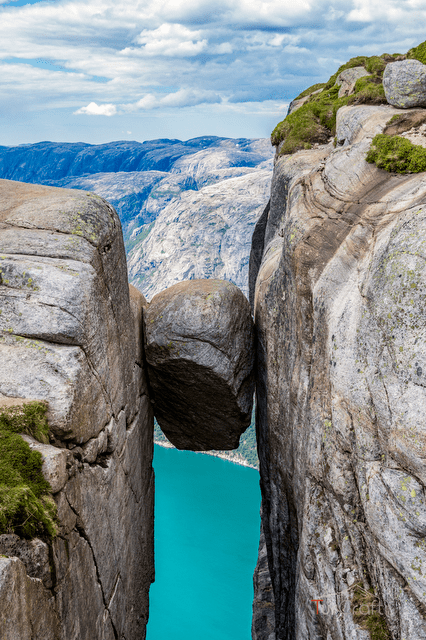
Kjeragbolten appeared less like a finish line and more like a pause in the route. Some people waited for the photograph. Others stood back and looked at the boulder from safe ground. I treated stepping onto it as optional. The hike had already done enough; the decision did not need to prove anything.
The return followed the same way back. That sounds simple until the chain sections come in reverse and the legs are less fresh. I kept my pace quiet, used the chains again where they helped and saved attention for the descent. The last part of Kjerag is not the boulder. It is getting back well.
Was the Kjerag hike worth the effort?
For me, Kjerag was worth it because the day had texture. It was not only the photograph, not only the boulder, not only the fjord below. It was the way the route changed character: steep from the start, careful on the slabs, open on the plateau, then quiet again on the way back.
It would not have been worth forcing. If the rock had been wet, if the wind had pushed hard across the plateau, if the group had been tired before the first climb, the better decision would have been to wait. Lysefjord does not disappear because one hike moves to another day.
That was the quiet lesson of the route. Kjerag rewards the travelers who leave room around it.
What I would remember
I would remember the first steep pull from the parking lot, because it made the day honest immediately. I would remember the feel of the chains in my hand, not as drama, but as a practical help on smooth stone. I would remember the plateau, where the land widened and the weather seemed to speak more clearly.
And I would remember that Kjeragbolten was not something the trail owed me. It was something I reached because the day allowed it: enough time, enough visibility, enough care left for the walk back.
FAQ
Kjerag hike questions I would answer first
- How long does the Kjerag hike take?
- I would plan for 6-8 hours for the 10 km round trip, with extra margin for weather, photos and the descent.
- Is the Kjerag hike difficult?
- For me it felt moderate to demanding: steep rock, chain-assisted slabs and weather exposure matter more than distance alone.
- Can you step onto Kjeragbolten?
- Some hikers do, but I treated it as optional. If the rock, wind or my confidence felt wrong, I would stay back.
- When is the best time to hike Kjerag?
- I would look at May to September, depending on snow, then choose the safest current weather window.
- Where does the Kjerag hike start?
- The route starts from Kjerag Parkering at Øygardstøl, where I would check parking, road and trail conditions before setting out.
- Can I bring a dog on the Kjerag hike?
- Yes, but I would keep the dog on a leash and only choose this hike in stable conditions. The steep slabs, chains and weather exposure can make the route harder for dogs than the distance suggests.
Map
I used the map as orientation, not as permission. Check current local conditions, trail notices, weather and parking information before starting, especially early or late in the season. Save the route or an offline map before leaving reliable mobile coverage.